Day 7–February 13

Hole in the Wall—Vero—Ft. Pierce—Stuart (Hooker Cove)

Another restful night, thanks to Capt. Chris.  His advice for this anchorage had us positioned well to get a little south breeze, and yet be protected from the boat traffic wakes on the ICW.  With only 33 miles to our destination of Stuart, we started the day slowly and moved at that pace most of the day. I am sensing I need to do something to work on my reflexes, because living the trawler life doesn’t exactly demand a quick reaction to anything…other than a sandbar.  There are times when it is critical to think quickly, but there are often hours between those moments, so sometimes the most dangerous this captain at the helm are the moments when nothing is happening, and staying awake is the biggest challenge.

When we did get moving, we headed out the same way we came in.  Side bar:  The tide swing here is less than a foot.  That’s good when you’re at anchor.  Not much to worry about when sleeping.  But when  dealing with shallow water, sometimes we count on a higher tide. For example, when the inevitable shoal finds the bottom of your boat, the rising water will eventually deliver you.  But here, at this spot, not so much the case.  I followed my track that we made coming in yesterday.  Hard to believe it, but that was not a good idea.  I hit the shoal we hit yesterday.  No problem, I thought.  I’ll just power through again.  I managed to wedge our keel deeper into the shoal before the boat came to a complete stop.  No problem, a little thrust to the left, then to the right, and then reverse and we will be on our way…I thought.  I checked the tide chart, looking for the water I would gain. It measured I would gain about .2 (yes, 2/10) of a foot…in 3-4 hours!  Amanda asked if I wanted her to call Tow Boat US.  “Not yet!”, I said.  I thrusted a little more, reversed a little more (red lined the engine) and BAM, the Honey Queen broke loose and started moving backward.  We got lucky.  The beauty of going so slow is we did not wedge ourselves too deeply into the shoal.  We picked an unlikely route out of the side channel that ended up being the right choice.  We found some 8’ plus deep water and puttered back into the ICW. 

We had some weather today, but not too threatening.  The water was fairly open, so we got to meet a few of the Florida Arrogant Big Boaters (FABBs).  These guys love their big boats more than they love people. Most are blind to trawlers and other “lesser” watercraft.  They throw 6’ wakes and generally enjoy the middle half of the ICW. Their time is obviously, very important because they don’t slow down. It takes them too long to get back on a plane if they slow down, not to mention the burn rate on fuel of 50 gallons per hour…per engine.  This is really my only complaint about South Florida.  The rest is pretty nice.

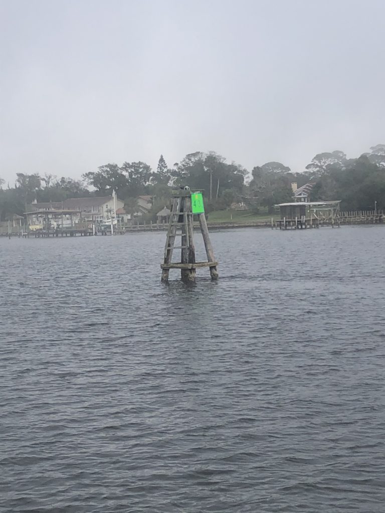
We saw our first green water today. Ahh…

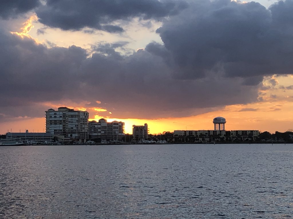
Condos along the ICW enjoy beautiful views.
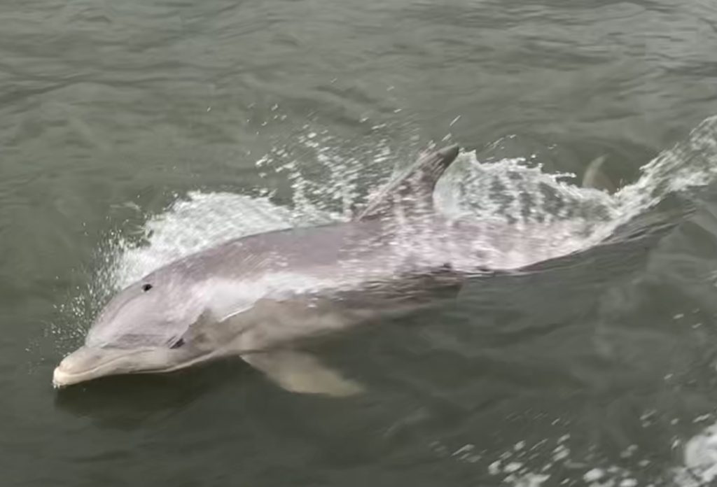
We arrived at Hooker Cove, coincidentally, about the same time as yesterday’s schedule, 4:45.  Six hours underway took us to this great, very open anchorage, which is known as a great take off point for crossing the Okeechobee.   This is the end of the St. Lucie River.  The basin is pretty large, but well protected. But I’m sure it can get pretty choppy on very windy days because of the shallow water.  But our time on the hook gave us just a nice breeze.  And the best part, there was not another boat that anchored in our sight, so we pretty much had it to ourselves.  And because of the size of the basin, the homes on the water are far enough away so we don’t feel like we pulled up in someone’s back yard and camped out.

We arrived at our first critical destination a day early.  This is Saturday afternoon.  We have an appointment in the boat yard for 9:00 am Monday morning.  If we had had any inclement weather, we would not have made it today.  But our aggressive miles earlier in the week, complimented by mostly good weather, have us ahead of schedule.  We will look forward to Sunday, and make it a day of rest.

Day 6–February 12

Cocoa—Melbourne—Palm Bay–Sebastian–Hole in the Wall(N of Vero)

W. Cocoa Beach Causeway Bridge where we spent last night

Left Cocoa Beach Anchorage around 8 am. It’s the first morning we’ve not had a fog excuse for getting up early.  The anchorage, though near the bridge, was quiet and well protected, so it was another good night.  We’ve been blessed by nice weather and temperatures.

One small addition we made to the boat since the Loop was fans.  We installed 4—12volt fans; 2 in the state room, 1 in the pilot house, and 1 in the salon.  Now that we’ve gotten further south, the moving air feels nice with the higher temps. The low voltage fans pull fewer amps from the house batteries than using 120 volt fans, through the inverter.  We also added a new 12-volt freezer.  This will allow us to keep more meat and frozen goods on hand for our trip to the Bahamas.  Our hope is to spend more time on the hook and less time in marinas and grocery stores.  The fans and the freezer have been a pleasant surprise regarding amp usage, drawing less power than expected, extending battery life in between charges by the generator.

I touched base with our former training captain, Chris Caldwell, from Vero Beach, and got a heads up on a good anchorage. He said the Hole in the Wall anchorage, near Pine Island/N. of Vero Beach, was good. So we charted to the spot and headed that way.

The day was pretty uneventful, for the most part. We did bump the bottom at 4 1/2′ (our boat drafts 4′-9″) as we came off the ICW into the anchorage. I took a chance and powered my way through, hoping for deeper water beyond the shoal. It’s probably not a good idea to do that, but the charts showed deeper water just beyond, so I went for it. We got lucky and just a few feet later, we were floating again, without noises coming from below. We got to the spot about 4:45, taking about 6 hours to arrive. It was early enough to allow a few minutes on the bow cushion to enjoy the warmth of the day and watch another boat fight getting their anchor unstuck from the soft mud. Temps ranged from 75-80 degrees and the weather was quite pleasant.

2021 Adventure Savannah-Keys-Bahamas Days 1-5

Since completing the Loop, we have been busy on the home front.  We spent the summer getting our home ready to sell.  Twenty-two years in one place means lots of accumulation.  Much of that accumulation is good.  Memories, mainly.  Amanda worked herself into the ground trying to sort and sift the “stuff”.  If I could have helped her, she still wouldn’t have let me.  It was important to her to touch everything and make rational, non-emotional decisions. I worked on the house itself, making tons of minor repairs from wood replacement to driveway sections.  Had to sub out a few things beyond my skill set, but by November, the house and yard looked great.  We listed the house with our friend Joe Dyer and 7 days later, we were under contract.  While the house prep was going on, we were also looking for our new home. We closed on our new home before we had a contract on our existing, but it all worked out. We survived the move and will probably be unpacking and organizing for months to come.  With the “home “work behind us, we scheduled our next boat trip.  The goal is to spend a month in the Keys and 2 months in the Bahamas.  We hope Covid will be cooperative this year and allow it to happen.  We’re grateful for the opportunities to travel and enjoy our retirement, knowing so many have problems MUCH BIGGER than ours. How this little adventure turns out, is yet to be determined.

Day 1–February 7

Delegal Creek–Ossabaw Sound–St. Catherine Sound–Sapelo Sound–Altamaha Sound.

Having finished the Loop on June 7, 2020, our 8-month landlubber sabbatical has finally ended. After a number of frustrations getting boat repairs, all issues (that we know of) were resolved on Saturday, the 6th. Ben helped me get it put together Saturday morning and we did a sea trial up Delegal Creek (I guess it was a creek trial, technically) to be sure all was holding well.  Our Democratic friends will be disappointed that we did not get rid of our generator and engine and install solar panels this year.  Once all the new jobs are created by the solar industry and there’s no more diesel fuel, we will make the improvement to our little mobile home (boat).

Completing the Loop makes you a gold Looper. We proudly display the burgee.

We pushed our 40-mile plan to 53 to close the gap on the late (later than planned) start date.  We have an appointment at a boatyard in Stuart, Florida, for a bottom job.  No plastic surgeons will be involved; we simply need to put a coat of paint on Honey Queen’s bottom.  We left small paint deposits on sandbars along our last 6,000 plus mile trip.  So it’s time. With our appointment on 15 February, we are pushing to be in Stuart on the 14th

After crossing 4 sounds and some really shallow water, we made it to our first anchorage, called Wally’s Leg, near St. Simon’s Island.  With a nip in the air, the skies were clear; we enjoyed the stars for 5 minutes before going in and literally pulling the covers up over our head to stay warm.

Day 2–February 8

Wally’s Leg—St. Simon’s Sound—St. Andrew’s Sound—Cumberland Island—St. Mary’s Inlet—Fernandina—Sister’s Creek/Jacksonville

We pushed again, covering 63 (nautical) miles, 20 miles farther than the original plan.  Sister’s Creek is a free city marina.  Though no electrical or water connections, it does provide a secure place to tie lines and helps us sleep a little better, not having to be concerned about a dragging anchor.

Recovery of the toppled cargo ship loaded with new vehicles at St Simon’s continues.

Not a great picture, but the eagles are always a highlight.


We saw so few on the Loop and were surprised to see 3 so close to home.

Day 3–February 9

Sister’s Creek—Pablo Creek—Palm Coast

Our early start from Sister’s Creek was delayed 3 hours, thanks to the fog.

We rose early at Sister’s Creek, ready to attack the day.  The fogged rolled in at daybreak, so we sat for 3 hours before leaving.  Assuming it would be impossible to make our 53-mile plan, we agreed we would go as far as safely possible and call it a day.  With a little help from the tides, we made better than expected time.  We decided to push to Palm Coast City Marina, though it would be after dark.  We called and they assured us someone would be there to direct us to our spot and catch our lines.  A live-aboard couple did meet us and gave us a hand, as promised.  Rosine, the dock master at the marina is a cordial professional and we appreciate the work she and her staff do for folks like us.

Day 4–February 10

Palm Coast—Flagler’s Beach—Daytona—New Smyrna Beach

We woke again to fog, it cleared, we took off. Ten minutes later, we ran into another wall of fog.  We puttered at 3 knots for several miles, with visibility sometimes as little as 50 yards.  Usually, crab traps are such a pain when navigating, but this morning, they were my friend.  Spaced along the edge of the channel of the ICW, I was able to keep one of them in view most of the time.  Them, and my radar, got us safely through the fog.  Two more times, as we travelled, we ran into fog.  But visibility was bearable and we kept moving. We covered 38 miles (our shortest since leaving) and arrived in NSB just after 4 pm.

More fog….today 3 times.

This is just another channel marker, but this particular one is where I got my first driving lesson. Our training captain taught me how to “kiss the dock” by driving the boat up to this marker.


John and Karen DeYoung, friends we made last year south of Chicago, have a home in NSB.  They came by and picked us up at the marina and we had a walk on the beach and then dinner at The Garlic, a fabulous Italian restaurant.  It was fun to catch up with them, continue our friendship, and look forward to our next visit with them…somewhere.

Day 5–February 11

NSB—Indian River—Edgewater—Titusville—Cocoa

For the 3rd day in row, fog was waiting on us when daylight hit.  Plans to hit it at daylight and arrive at a planned destination early were foiled again.  We piddled until 9 am. The fog lifted and we took off.  Today was easiest day yet on this brief journey.  The distance was 45 miles, but the vast majority of the travel was literally in a straight line.  Setting very few waypoints on the trip plan, I was able to set Auto Pilot and sit in the pilot house and watch the boat do its thing.  The weather turned beautiful with temps hitting the low 70’s and bright sunshine.  We enjoyed having the windows and doors open and wearing shorts and T shirts.

Sunset over Cocoa

We made it to Cocoa and dropped the anchor at the W. Cocoa Beach Causeway Bridge.  Winds were out of the south-southeast, so we tucked in on the north side for protection from the forecasted light breezes and rain tonight.

This cool sunrise was caught by our rear view camera on the boat.